
1. Client Consultation
We begin by understanding the client's requirements, project objectives, and the purpose of the land survey. Our experts discuss the scope of work, project timeline, and expected deliverables to ensure clarity and transparency.
This step helps us design a precise survey strategy tailored to the site conditions and client needs.
2. Site Inspection
Our professional survey team visits the site to evaluate terrain conditions, boundaries, existing structures, and accessibility. This step allows us to determine the best surveying methods and equipment to use.
Proper site inspection ensures that data collection is accurate and efficient.
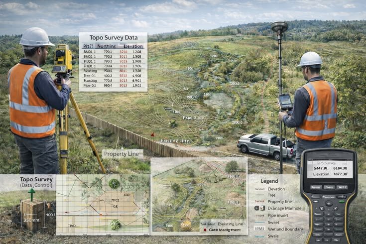

3. Field Data Collection
Using advanced surveying equipment such as Total Station, RTK GPS, Drone Mapping, and 360° scanning technology, we capture accurate spatial data from the site.
This step ensures millimeter-level accuracy for land measurements and digital spatial mapping.
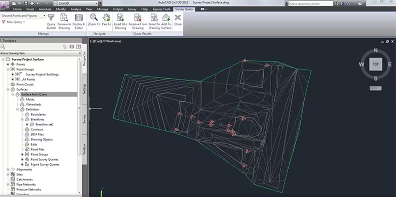
4. Data Processing & Analysis
Collected field data is processed using advanced GIS software, CAD systems, and spatial analysis tools. Our team converts raw data into accurate maps, models, and geospatial insights.
This process ensures reliable results for planning, construction, and land development.
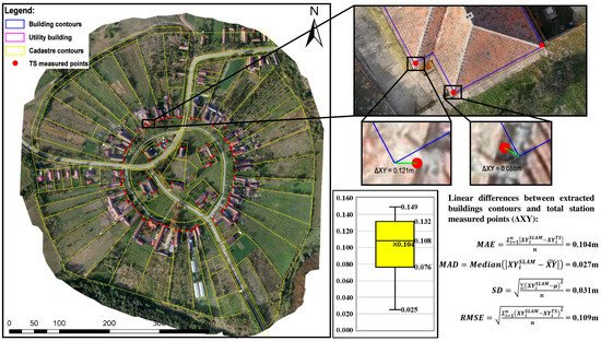
5. Map & Report Generation
After processing the data, we create detailed survey drawings, GIS maps, digital terrain models, and professional reports.
These documents provide clear insights into land boundaries, topography, and spatial relationships.
6. Project Delivery
The final deliverables including maps, drawings, and reports are delivered through our secure digital client portal. Clients can easily access and review their project files anytime.
Our goal is to provide clear, accurate, and reliable survey information for better decision-making.